The old mining town of Reveille is located on the east slope of the Reveille Mountain Range, overlooking the northern part of Railroad Valley. It is about 40 miles northwest of Rachel, less than an hour drive, and well worth a visit.
Like many mining towns of the 19th century, Reveilles life was short but turbulent. Founded in 1866 as a silver mine it bloomed to several dozen individual mines within the first year. But when the claims proved less than profitable, the miners moved on, and by 1880 Reveille was virtually deserted. A few mines were worked on and off until 1945, when Reveille was abandoned for good. Besides silver Reveille also produced gold, copper, lead and antimony.
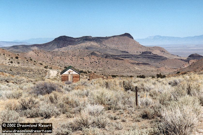
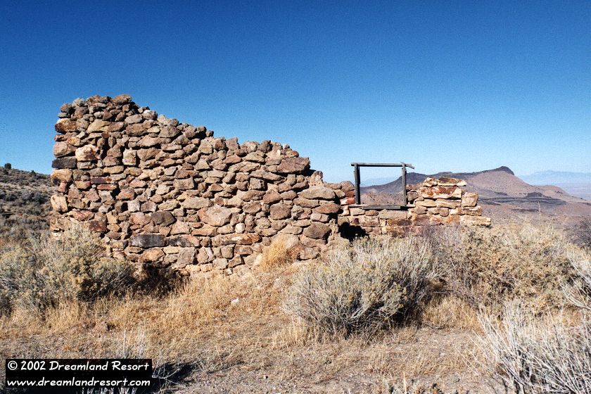
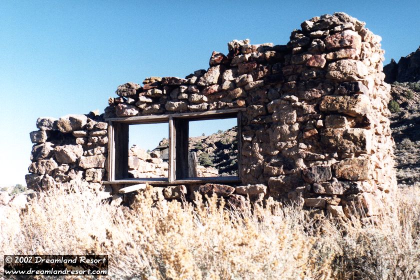
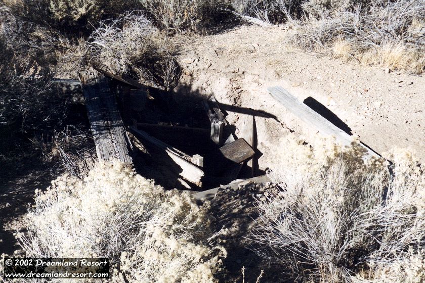
Today many stone foundations and one wooden cabin that mysteriously remained intact tell visitors a story of the good old days. There are actually two parts: the main settlement along the main road and Old Reveille about a mile further north, which has some interesting remains of old mining equipment. Both are worth exploring, but watch out for vertical mine shafts. Reveille also makes an excellent sheltered campsite away from the highway.
There is a network of interesting back roads, probably established by prospectors, leading into the Reveille Mountain Range from here. If you decide to explore them be sure to have a good topo map of the area. Some of the back roads past the settlement are very washed out and should only be used by experienced four-wheelers. It is a long walk back to the highway if you get stuck.
If you follow the main road past the wooden cabin for about a half mile, heading roughly south, you come to an intersection with the remnants of another wooden building. It is completely destroyed and collapsed. It shows up on satellite images between 2007 and 2010 and was destroyed in the spring of 2014. It is likely related to some recent prospecting in the area.
Directions
From Rachel turn left onto Hwy 375 north. After about 37 miles you come to an intersection with a dirt road on the left, and a somewhat faded sign "Reveille". Turn left onto the dirt road and head towards the mountains. Keep following the main dirt road. After about 6.4 miles you come to a fork in the road. "Downtown Reveille" is just past that fork. Some sections of the dirt road are washed out. High clearance is required, 4WD recommended.
To get to the actual mining operation Old Reveille turn right at the fork and follow the road north, then west for about 1.5 miles.
The only intact building, probably a newer addition. In the background Railroad Valley. [11/13/1999]
Same view, 19 years later. The cabin has not changed much. The hook-ups of an old trailer park can be seen in the foreground. [07/25/2018, click to enlarge]
Room with a view...
Spacious, sunny, well-ventilated fixer-upper with panorama windows and a gorgeous view. Quiet neighborhood, near downtown. Very affordable. ;-) [11/13/1999]
Vertical mine shaft. They are all over the place and sometimes hard to see. Watch your step. [11/13/1999]
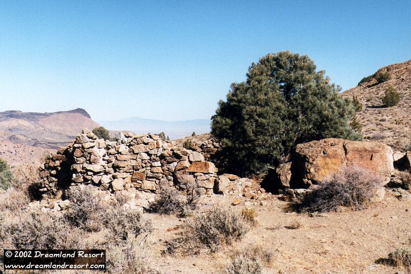
Nature slowly reclaims the ruins. [11/13/1999]
Aerial view of "Downtown Reveille", looking south-west up the canyon. [07/25/2018, click to enlarge]
Last chance on that fixer-upper... anyone?? [07/25/2018, click to enlarge]
Ok, so the roof may need some repairs... [07/25/2018, click to enlarge]
Remains of a wood shack erected between 2007 and 2010, likely by recent prospectors in the area. It was destroyed in spring of 2014. [07/25/2018, click to enlarge]